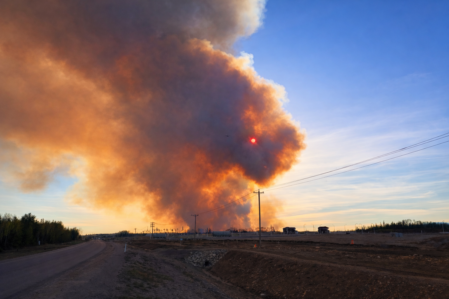
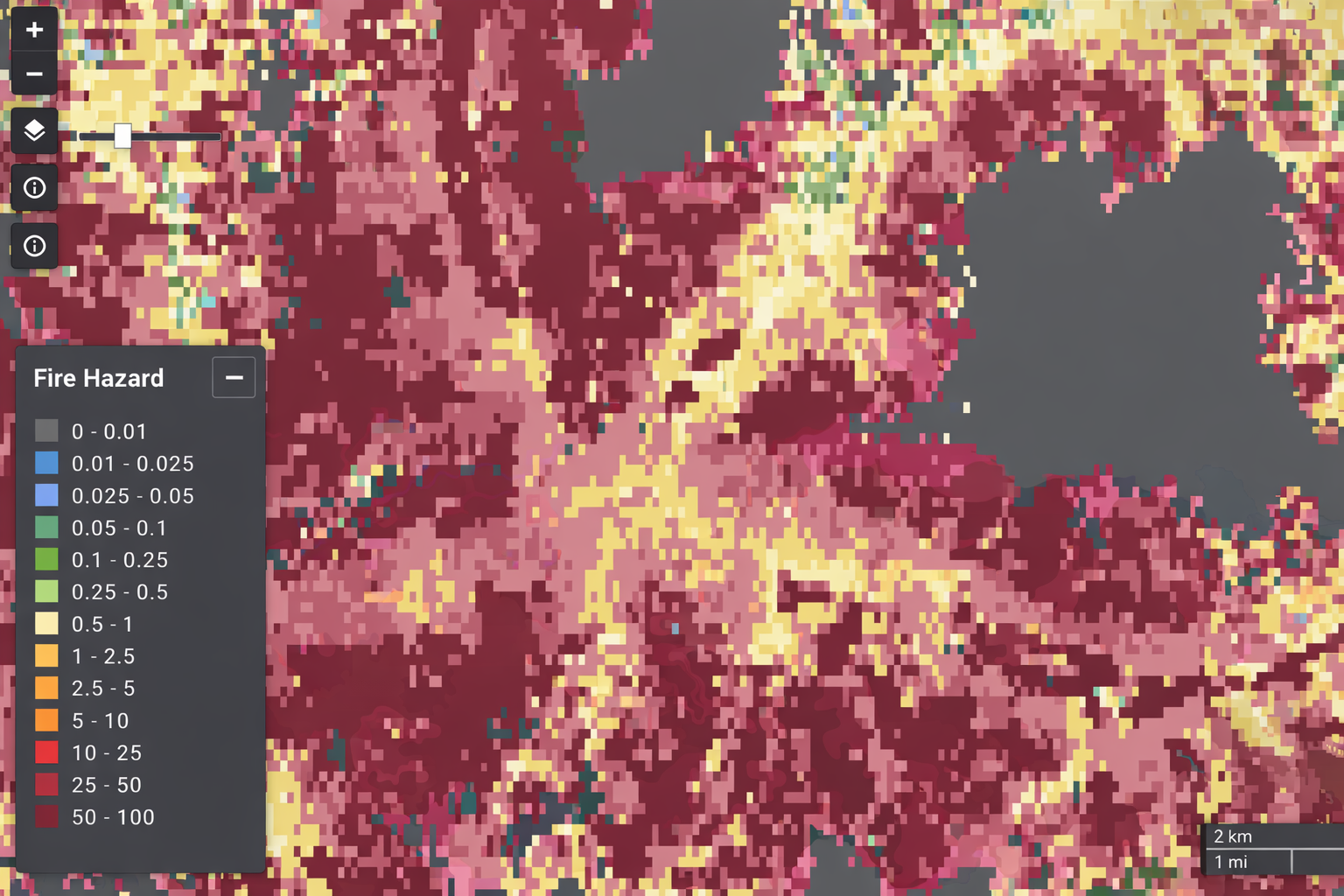
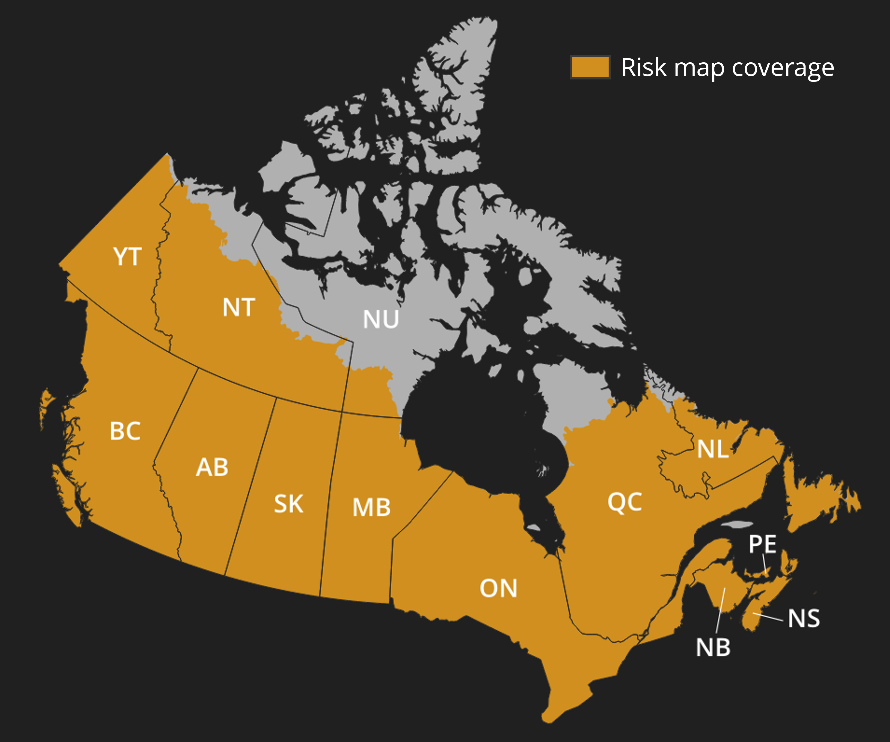
Wildfire Hazard Data at 30-meter resolution — updated annually to reflect changing vegetation, climate, and land use. Built on peer-reviewed science. Trusted by insurers, utilities, and land managers across Canada.
In 2016, a single wildfire destroyed 2,400 homes in Fort McMurray, Alberta — causing a record $3.7 billion CAD in insurable losses. Across Canada, 1.9 million buildings are directly exposed to wildfire, and 13 million people live in wildfire-prone areas.45 Static risk maps and outdated assessments leave all of them exposed. Your wildfire hazard data should keep pace with the risk landscape.
Wildfire Hazard Data delivers continuously-updated fire risk intelligence at 30-meter resolution across Canada, built on peer-reviewed science. From utility corridors to insurance portfolios, make confident decisions with data you can trust.
Built on published, peer-reviewed science with transparent, reproducible methods. Defensible data you can explain to stakeholders.
Building-scale precision for accurate risk assessment and targeted action. See individual structures and neighbourhoods, not broad regional averages.
Reflects latest vegetation, climate, and land use changes. Your data stays current as conditions evolve.
Access via web browser, GeoTIFF download, or API integration. Fits your existing workflows and systems.
Price risk with precision, not proxies
Coarse-resolution wildfire models miss property-level variation, leading to mispriced policies and unexpected loss ratios. Wildfire Hazard Data delivers the granularity needed for accurate underwriting and portfolio management.
Protect assets and infrastructure before the threat arrives
Wildfire risk from vegetation contact threatens grid reliability, triggers PSPS events, and creates regulatory exposure. Pipeline networks, telecom facilities, and transportation corridors face the same growing threat. Wildfire Hazard Data enables proactive risk management and defensible compliance documentation across your entire asset footprint.
Protect timber value and plan with confidence
Wildfires threaten timber investments, carbon credits, and decades of forest management. Wildfire Hazard Data enables prioritized resource allocation, strategic harvest planning, and informed prescribed burn decisions.
Plan with confidence for the communities and lands you steward
Municipal, provincial, and Indigenous governments need credible, high-resolution wildfire risk data to inform zoning, forest management, conservation, and community safety planning. Wildfire Hazard Data provides the science-based foundation for defensible decisions at every level of government.
Our data covers virtually all of Canada's wildfire-prone landscapes — every province, the Yukon, and the Northwest Territories.
Select your geographic area of interest from our Canada coverage map
Access via web browser, download GeoTIFF files, or integrate via API
Prioritize maintenance, underwrite accurately, or plan fuel treatments
See how Wildfire Hazard Data compares to alternatives
| Recommended Wildfire Hazard Data | Generic Wildfire Maps | In-House Analysis | |
|---|---|---|---|
| 30-Meter Resolution | 250m–1km | Varies | |
| Annual Updates | Static | Rarely | |
| Peer-Reviewed Science | |||
| Canada-Wide Coverage | Often regional | Limited | |
| Multiple Delivery Formats | Single format | Varies | |
| Defensible Methodology | |||
| Ready in Days | Weeks+ | Months+ |
Most customers receive access within 1-2 business days of completing their agreement. Enterprise integrations may require additional setup time.
Yes. We offer sample data downloads and demos to help you evaluate fit. Contact us to request access.
Wildfire Hazard Data currently covers Canada. Coverage is expanding; contact us about specific regions.
Wildfire Hazard Data is provided at 30-meter resolution, enabling building-scale risk assessment.
Data is updated annually to reflect changes in vegetation, climate patterns, and land use.
Data is available via web browser, GeoTIFF download, and REST API. Enterprise customers can request custom formats.
GeoTIFF files work natively with all major GIS platforms including ArcGIS, QGIS, and Google Earth Engine.
Our methodology combines vegetation type, topography, climate data, and historical fire patterns. It is built on peer-reviewed science and NRCan's established fire modelling methods (Burn-P3+).
Yes. Our methods are built on peer-reviewed scientific literature and NRCan's validated fire modelling framework. We also conduct ongoing validation against observed fire behavior.
Licensing is typically annual and based on coverage area and delivery method. Enterprise agreements offer custom terms.
Yes. All plans support multiple users within your organization. Enterprise plans offer unlimited seats.
Get high-resolution, current, and credible wildfire hazard data today.